Iceland has a circular route that allows you to explore the entire country in just a few days. The Ring Road, which encircles the entire perimeter of the large island, can be covered by car in less than seven days… but if you want to enjoy every stop, you’ll need at least fifteen. It’s virtually impossible to describe all the wonders this itinerary holds, one by one. Therefore, we’d like to recommend the most iconic and fascinating locations, which you can use as reference points or bases. If you’d like to embark on this adventure, the best airport to consider is Reykjavik Keflavik (KEF), as the Ring Road begins and ends in the capital.
When to go and how to get there
If you want to travel the Icelandic Ring Road, do it between July and September, although even in October the weather offers beautiful days and captivating colors.
Always rely on experienced locals for travel. Iceland’s climate is often unpredictable, as freezing winters can unexpectedly arrive months in advance, accompanied by severe weather events. Always check weather conditions and road and bridge closures if you’re venturing alone, and never go it alone.
The most beautiful stages of the Ring Road: from west to north
As mentioned, the journey begins in Reykjavik, the pearl of the west and Iceland’s national capital. Famous for its modern and clean downtown, centered around the colossal concrete cathedral, Reykjavik is also renowned for the Fagradalsfjall volcano, which split the earth near the town of Grindavik, creating a fiery spectacle that attracted tourists for months in 2021. Beginning the circular route, you’ll head toward the north coast, and you can immediately stop at the Snaefellsnes peninsula to admire another famous volcano: Snæfellsjökull, submerged by the ice of a perennial glacier and the source of inspiration for Jules Verne’s “Journey to the Center of the Earth”!
The “capital of the north” is the town of Akureyri, a splendid panoramic setting rich in culture (museums, churches, botanical gardens) and leisurely entertainment (the bars and cafes near the harbor). From here, it’s easy to reach the spectacular Goðafoss waterfall, created by the Skjálfandafljót River, which here drops 12 meters and is 30 meters wide over a deep ravine. Continuing towards Husavik, you might want to stop to admire the lava pillars—the “black columns”—of Dimmuborgir. Husavik is famous for whale watching, as they often come to rest just off the town’s beaches.
Returning inland, you’ll find Lake Myvatn, a body of water surrounded by craters, lava tubes, and fractures. It’s no coincidence that just a few kilometers from here lies the famous Mid-Atlantic Ridge, the great fault line that marks the collision between two continental plates… This is the only place where you can literally stand “with one foot in Europe and one foot in America”! Finally, you’ll reach Hverir, a geothermal area known for its hot mud pools and fumaroles of sulfur and steam. From here, the descent toward the east coast… the “fjord” coast… begins!
The most beautiful stages of the Ring Road: from east to south
The town that dominates the fjord coast… does not overlook the sea, a typically Icelandic paradox: Egilsstaðir is famous for its thermal baths, its museums, its art galleries, and above all for being the starting point for adventurous excursions amidst wild and captivating nature. Continuing the eastern route, you return to the sea and finally encounter the first true fjords, such as Reyðarfjörður or Djúpivogur, which winds between the bodies of enormous, sharp-peaked rocky mountains covered in “elven” forests where Iceland’s auspicious spirits live.
You have to head south to find the most spectacular fjord of all: Diamond Beach extends for several kilometers toward an enormous glacier… and the “diamonds” are the many icebergs continually floating on the sea. The glacier mentioned is Vatnajökull, the largest in Europe, which juts out into the sea from the heart of southern Iceland.
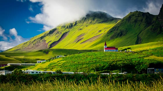
Don’t miss a visit to Skaftafell National Park, home to wonders such as the “black waterfall” of Svartifoss, which jumps from several meters-high basalt rocks, amidst glaciers and ancient canyons. Another magical place in southern Iceland is the Dyrhólaey peninsula, meaning “gateway passage” due to its large volcanic rock arch emerging from the sea. In addition to the beautiful views, the peninsula is a sanctuary for many seabirds, including the beautiful puffins that nest here. The tour ends at the famous black beach of Reynisfjara, where you can stop for a few romantic photos before the final stop in Selfoss (not to be confused with the waterfall of the same name located to the north), a fishing village that still retains its ancient Viking soul.

